A curved line with a job to do
In a photograph of flooded rice terraces, the field edges can look like lines drawn purely for pleasure. They bend, meet and separate; reflections turn the spaces between them into pieces of sky. But the edge is also a boundary with work to do. Before asking where to stand for the best picture, ask what is being held, moved and maintained.
At the Honghe Hani Rice Terraces (红河哈尼梯田) in southern Yunnan (云南), UNESCO describes an integrated landscape of forests, water supply, villages and fields. It traces channels from wooded mountain areas to the terraces and links their maintenance to community structures. The visible shape is part of a larger arrangement, not a decoration laid over a mountain. [1]
This route concerns two terrace areas in Yuanyang County (元阳县): Duoyishu (多依树) and Bada (坝达). The names identify places within a wider cultural landscape, rather than interchangeable viewpoints on one compact attraction.
Look uphill before looking down
The official heritage account places villages between the upper forests and terraced fields, and describes a network of communally maintained water channels. It also identifies an integrated farming system involving red rice and animals. We should not turn those descriptions into a claim that every field or household works identically, or that every visible building preserves an untouched historic form. [1]
Our interpretation: a view down the slope is incomplete if everything above the topmost field is treated as background. A forest can matter to the scene without appearing prominently in the frame. A village can be more than a picturesque interruption. The useful subject is a relationship between places, including relationships that a photograph cannot show at once.
That changes a good viewing exercise. First find the nearest clearly visible field edge from a permitted public viewpoint. Then try to identify a channel or connection without stepping closer onto cultivated land. Finally look uphill and ask where the water might be supplied from. Your sketch can contain a question mark: guessing an unseen channel’s route is not the same as learning it.
For a guide, ask for one documented explanation of water allocation or maintenance. Do not ask somebody to perform ordinary farm work merely so that the scene looks more authentic. A functioning landscape has a timetable of its own, and a visitor is not entitled to rearrange it.
The winter photograph is not an October forecast
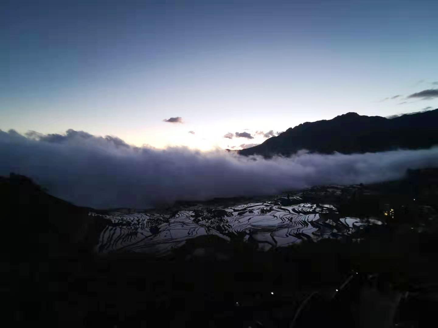
The image on this page was made at Duoyishu on 20 December 2019. Its reflective fields and mist belong to that recorded moment. They establish neither the crop stage nor the visibility on a future date. Even the season of an archive photograph is worth putting into the caption: otherwise an attractive image quietly becomes an impossible promise.
Water, crop growth, light and weather change the picture. If your main objective is a particular field condition, ask a local host for a recent, dated view and an explanation of the current agricultural stage. If your aim is understanding the landscape, a day without dramatic colour can still be useful. Neither cloud nor clear sky grants permission to enter a field.
UNESCO’s inscription-era material raises the tension between conserving traditional houses and residents’ changing needs. That is a historical management concern, not a survey of present household preferences. It nevertheless gives a visitor a useful ethical question: can we value a place without demanding that its residents keep living inside our preferred image? [1]
A deliberate route from Xinjie
This is a researched proposal, not a journey we claim to have made. Base it on an overnight stay in or around Xinjie Town (新街镇) and a prearranged return vehicle. Keep long-distance arrival and departure separate from the viewing day. Confirm the actual hotel pin: “Yuanyang” alone is too broad a pickup instruction.
The Ministry of Culture and Tourism’s rural route includes Bada, Shengcun, Duoyishu and other villages and viewpoints. It establishes a useful regional cluster, but it is promotional route material rather than a current transport schedule. Our shorter selection does not imply that every listed site is open, ticketed together or walkable as a continuous trail. [2]
- Start after breakfast, unless dawn access is specifically confirmed. Arrange pickup from your named accommodation and agree the entrance at Duoyishu. If sunrise matters, separately confirm the date’s opening, safe approach and driving arrangements. Do not choose an unlit shortcut to gain a few minutes.
- Duoyishu: allow 45–60 minutes at permitted viewing areas. Begin with the large shape of the slope, then choose one nearby field boundary to follow with your eyes. Note where the cultivated surface meets settlement or vegetation. Treat these as looking exercises, not measurements of hydrological performance.
- Return to the vehicle and pause for lunch. Agree the stop with the driver and host. Shengcun (胜村) appears in the official regional route, but this article does not promise a market on your day. A meal and a toilet break are useful even when there is no event or performance to collect.
- Bada: allow another 45–60 minutes. From an open designated viewpoint, compare the organisation of the slope with Duoyishu. Make a second sketch using the same categories—fields, settlement, vegetation and visible water connections. Comparable questions reveal more than another attempt at the same panoramic photograph.
- Return to the original accommodation. Leave enough daylight and road-time margin for the actual conditions. These are on-site planning allowances, not verified driving times or an operator’s total tour duration. The route needs arranged transport; it is not presented as a walk between viewpoints.
What to confirm for your date
Ask about current entrance names, opening and last admission, tickets or reservations, passport handling, road conditions and any temporary closure. We have not verified an October 2026 admission price, bus service or access bulletin and quote none as current. For reduced mobility, request actual walking distances, gradients and steps at each selected viewpoint.
Do not add a village-home visit by assumption. A public lane, a visitor service and a private threshold are different spaces. Ask before photographing people closely, entering courtyards or approaching working channels. Any agreed guide or host fee should be clear before the visit, not negotiated as a reward for a staged photograph.
A Chinese brief for a landscape visit
我们住在新街镇附近,希望安排往返多依树和坝达的慢游,以了解森林、村寨、梯田和水系的关系为重点。请确认当天开放与门票预约要求、接送地点、步行距离和台阶、道路情况,以及午餐和返程时间。我们不进入田地、私宅或未开放区域,不需要安排摆拍或未确认的集市表演。请单列车辆、等候、讲解和门票费用。
The strongest souvenir may be a clearer account of one line in the landscape. A field edge can be beautiful while still being somebody’s responsibility. Keeping those facts together is more rewarding than turning either beauty or work into the entire story.
Build the detour into a realistic trip
Send your date, accommodation, arrival route, group size and walking needs through our existing planning form. Transport, guiding and personal coordination are separate services subject to confirmation. No dedicated Hani-terraces PDF is announced here; check the actual destination and preview before buying any existing guide.
Send a trip brief ↗Browse existing PDF guides ↗Preview member cultural deep reads ↗Official sources & further reading
- UNESCO: Cultural Landscape of Honghe Hani Rice Terraces — Integrated landscape and inscription-era management account; inscribed 2013. Historic planning statements are not treated as current visitor conditions.
- Ministry of Culture and Tourism: Yunnan rural terrace route — Regional route cluster and village context, 2023 collection; not a current transport or opening notice.
- World Heritage Committee decision 37 COM 8B.24 — 2013 recommendation concerning tourism and interpretation; further reading on what should be explained to visitors.
- Ping an Chang: Duoyishu photograph — 20 December 2019, CC BY-SA 4.0; photograph record and licence.
